Why the strongest hurricane on record was no ‘catastrophe’
- 18/11/2015
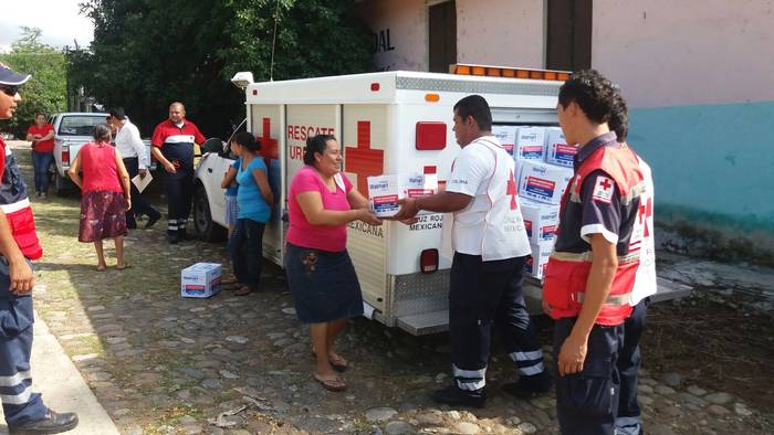
Volunteers from the Mexican Red Cross distribute humanitarian aid materials in anticipation of Hurricane Patricia. (Credit: Mexico Red Cross)

At its peak Hurricane Patricia was the strongest hurricane every recorded in the eastern Pacific packing maximum sustained wind speeds of an astonishing 320 kph. To put that into perspective, the Saffir-Simpson scale used to classify hurricanes defines anything above 252 kph as Category 5, or the highest rating at which “catastrophic damage” will occur.
Hurricane Patricia was extreme by other markers too including its central pressure, the lowest of any hurricane in recorded history in the eastern Pacific and very rapid intensification from a tropical cyclone to Category 5 hurricane.
NOAA (National Oceanographic and Atmospheric Administration) deployed the 53rd Weather Reconnaissance Squadron, aircrafts outfitted with meteorological equipment, to fly into Hurricane Patricia and provide forecasters a look inside the hurricane. Colloquially known as the Hurricane Hunters, these aircrews help to improve hurricane forecasting by providing direct measurements of wind speed, pressure and other variables that are important for models that predict the movement and development of hurricanes. Typically, these variables are only estimated using satellites, and before the advent of satellites in the 1970s we only had records if there were ships passing nearby so you can imagine how our ability to observe the strength and movement of hurricanes has improved.
Despite the record-breaking nature of Hurricane Patricia the anticipated catastrophic damage did not materialize for 3 main reasons:
- Patricia was unusually compact – the highest Category 5 wind speeds were concentrated in a 25km diameter band around its centre, the hurricane-force winds only extended about 55km from the centre limiting the area that the winds could impact
- We got lucky – the hurricane made landfall in a very sparsely populated area largely missing the major population centres in the resort down of Puerto Vallarta, and the port city of Manzanillo
- Preparation – The local, state, and national government coordinated an effective preparedness plan based on forecasts that included evacuation, alerts to local populations, and pre-positioning of humanitarian aid in anticipation of response.
Other factors such as the slope of Mexico’s coastline, the speed of the storm, the angle at which it approached the coast, and dry air over the mountains in the interior of western Mexico factored in to the impact Hurricane Patricia had in Mexico. Some of these factors helped to reduce storm surge, the mass of water that is pushed inland by a hurricane’s winds that usually causes the most damage.
In the BRACED context, the preparedness based on climate information enacted in Mexico gives us insight into what strengthening resilience against extreme events to prevent disasters can look like on the ground.
For example, the Mexican Red Cross says it acted during 3 key phases through analysis, anticipation, and timely and immediate response. Based on forecasts they established a preparedness plan that began 3 days prior to the forecasted landfall. This plan included mobilizing up to 500 volunteers to preposition and distribute 30 thousand kilos of humanitarian aid to the populations predicted to be in the path of the hurricane. They also mobilized volunteers to assess damage caused by Patricia in the states of Jalisco and Colima hours after landfall.
The misalignment between forecasts of catastrophic damage and actual impacts that resulted from Hurricane Patricia has some calling for a reworking of scales that are used to classify hurricanes to include more categories (above the category 5 cap) or other factors like physical size, precipitation, or pressure. Other scales such as the Hurricane Hazard Index take into account more variables than just wind speed, but are not officially used. While the debate continues, offer your thoughts in the comments section below.
The findings and conclusions detailed in this blog are those of the author(s) alone and do not necessarily reflect the views of the Red Cross Red Crescent Climate Centre, the IFRC or its National Societies. The blog and any links it may contain are offered to stimulate discussion and thinking on the humanitarian impacts of climate change and variability.
Video
From camel to cup
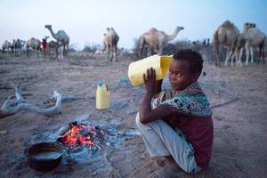
From Camel to Cup' explores the importance of camels and camel milk in drought ridden regions, and the under-reported medicinal and vital health benefits of camel milk
Blogs
As climate risks rise, insurance needed to protect development
Less than 5 percent of disaster losses are covered by insurance in poorer countries, versus 50 percent in rich nations
Disasters happen to real people – and it's complicated
Age, gender, ethnicity, sexual orientation and many more factors must be considered if people are to become resilient to climate extremes
NGOs are shaking up climate services in Africa. Should we be worried?
A concern is around the long-term viability of hard-fought development gains
The paradox of water development in Kenya's drylands
In Kenya's Wajir county, the emphasis on water development is happening at the expense of good water governance
Latest Photos


Tweets
© 2018 | Terms of Use
We welcome comments that advance the story through relevant opinion, anecdotes, links and data. If you see a comment that you believe is irrelevant or inappropriate, you can flag it to our editors by using the report abuse links. Views expressed in the comments do not represent those of Braced or its partners.