Myanmar Alliance: Improving access to climate risk information to inform community disaster preparedness and adaptation approaches
Click here to download the project brochure.
The BRACED Alliance is a partnership of 6 agencies, including Plan International Myanmar (working in partnership with Community Development Association), Action Aid, World Vision, BBC Media Action, Myanmar Environment Institute (MEI) and UN Habitat. A BRACED Alliance Coordination Unit is housed by Plan as lead agency.
The BRACED Alliance will implement a robust model of community resilience in eight townships in Myanmar covering Kyauk Phyu and Taungup Township, Rakhine State; Dagon Seikkan Township, Yangon Region; Hpa-An Township, Kayin State; Meiktila Township, Mandalay Region; Labutta Township. Ayerya- waddy Region; Mawlamyine Township, Mon State and Kengtung Township, Shan State that will inform and strengthen national level policy and processes.
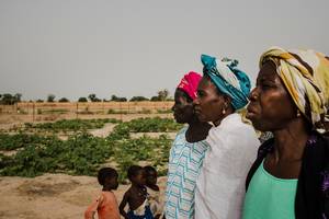
Based on the Alliance’s extensive experience in disaster risk reduction and management, the BRACED Myanmar resilience model aims to empower communities to take leadership in determining their local priorities for Disaster Risk Reduction and Climate Change Adaptation. The resilience model prioritises women and children as key drivers of community resilience and climate smart sustainable development.
Guided by the BRACED resilience planning framework, the project will facilitate communities to prioritise and select appropriate resilience building measures to address urgent and immediate needs identified through analysis of exposure to climate extremes, vulnerability and capacity to deal with disasters and climate change.
BRACED will then implement diverse resilience actions selected by communities. Activities at community level will include: women’s leadership training and self-help groups, climate resilient sustainable agriculture, CSO led ecosystem management, microfinance for strengthening resilience, village savings and loans associations, safer construction and settlement planning.
BRACED Resilience Pathways
The BRACED Myanmar resilience-building model promotes a participatory, inclusive and comprehensive process for resilience building, addressing country gaps and needs through five pathways of change (diagram coming soon).
The resilience pathways will result in strengthening the resilience of at-risk groups through:
- Increased preparedness and coping mechanisms to address more immediate disaster events as well as longer-term adaptation needs.
- Increased resilience of systems and livelihoods of most vulnerable people to sustain and diversify livelihoods in the face of climate uncertainty as well as better management of natural resources/ services (i.e. food, water, energy and ecosystems).
- Establishment of safety nets in communities (i.e. financial services and savings).
- Improved communications, access and use of resilience information including reliable environmental, early warning, weather and climate data and information, and enhancing ability to interpret information to aid decision making and planning at community level and in sub-national/national policies and strategies.
- Improved Decision-making and planning: creation of spaces for active engagement of vulnerable groups, particularly women and children, in resilience planning processes and sub-national mechanisms for multi-stakeholder resilience planning (eg: Monsoon Forum, SEA & EMPs).
What’s the right goal - resilience, well-being or transformation?
“How can we claim we are promoting resilience if we’re not paying attention to people’s priorities?”
Preparing for floods in Myanmar
From storing food to drying vegetables, this video explores how Burmese families are preparing for floods.
How can we measure resilience? Mobile phones – and the right questions...
Phone surveys and efforts to ask people what they think makes them resilient may change some old ideas
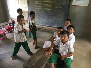
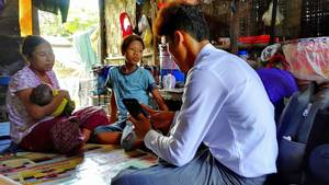
Want to understand climate change in Myanmar? Talk to kids
Children can play an important role in talking about climate change in their communities.
Lead Organisation
Consortium Partners
Newsletter
BRACED Updates
Wajir county opens GIS lab to support rangeland and water planning
Data collected will inform the location of water points
Promoting community initiatives and decisions making, an effective ...
Institutional anchoring has established transparency when funded projects are implemented
© 2018 | Terms of Use