Scientists to map quake-prone Asian region
- 05/01/2018
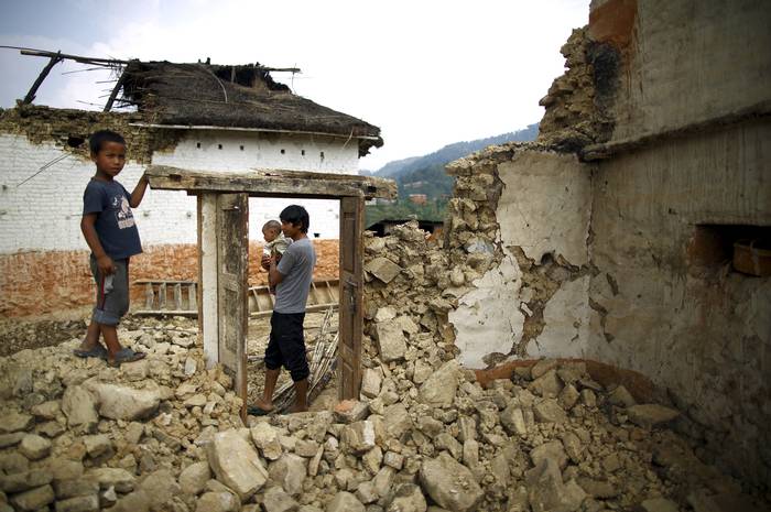
ARCHIVE PHOTO: Earthquake victims stand near the remains of a damaged house after the April 25 earthquake at a village on the outskirts of Lalitpur, Nepal, May 8, 2015. REUTERS/Navesh Chitrakar

An international team of scientists is set to begin a four-year project this month that will map, image and monitor an earthquake-prone area that encompasses some of the most remote and densely populated parts of Asia.
The $7 million project is partly led by Michael Steckler, a professor at Columbia University's Lamont-Doherty Earth Observatory. It will involve three teams planting sophisticated global positioning system stations, and more than 100 seismometers that detect tremors in Bangladesh and western Myanmar, along the so-called IndoBurma subduction zone.
A team in India will also begin work in the part of the zone that extends into the northeastern part of that country.
"This particular area has never been (mapped) before in anything close to this scale," Steckler told the Thomson Reuters Foundation on Thursday. "We know so little about what the geometry of the fault is under there that it is very hard to make accurate assessments."
More than 30 researchers from at least six countries will create a detailed image of the onshore subduction zone, which is also home to the world's largest delta system. It spans an area of about 700 km (435 miles) and is an extension of the zone that caused the tsunami of 2004 in the Indian Ocean, which killed more than 200,000 people.
Any future earthquake in the research and surrounding areas could impact 140 million people - many of whom are among the world's poorest - and cause the collapse of thousands badly maintained or constructed buildings, researchers said.
Steckler cited the Rana Plaza disaster in Bangladesh, which killed more than 1,100 factory workers in 2013, as an example of the potential risks that an earthquake would pose.
"A year and a half ago we published a paper saying that there was the potential for a large earthquake in this area," he added.
Following preliminary work carried out late last year, Steckler and his team will move a shipment of more than 1 tonne of equipment and instruments to a base outside Bangladesh's capital, Dhaka, later this month. Work will then be carried out in the northeast of Bangladesh. Teams in both India and Myanmar are due to begin work in March.
In addition to planting seismometers, researchers will conduct various studies, and collect and study rock samples across the three countries, with the aim of better understanding and minimizing the risks that any future mega-earthquake would have for the area.
It is also hoped that the studies will enable authorities to raise earthquake awareness and develop the most cost effective ways to keep buildings and communities safer, said Steckler.
Such initiatives are desperately needed in the region, which is one of the poorest and most densely populated in the world, according to Vineet Gahalaut, director of the National Centre for Seismology in New Delhi, who heads the Indian research team.
"Vulnerability is very high because the structures, conditions and preparations are poor, and awareness is less," he said.
Video
From camel to cup
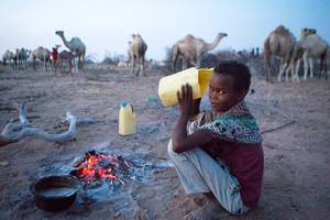
From Camel to Cup' explores the importance of camels and camel milk in drought ridden regions, and the under-reported medicinal and vital health benefits of camel milk
Blogs
As climate risks rise, insurance needed to protect development
Less than 5 percent of disaster losses are covered by insurance in poorer countries, versus 50 percent in rich nations
Disasters happen to real people – and it's complicated
Age, gender, ethnicity, sexual orientation and many more factors must be considered if people are to become resilient to climate extremes
NGOs are shaking up climate services in Africa. Should we be worried?
A concern is around the long-term viability of hard-fought development gains
The paradox of water development in Kenya's drylands
In Kenya's Wajir county, the emphasis on water development is happening at the expense of good water governance
Latest Photos


Tweets
© 2018 | Terms of Use
We welcome comments that advance the story through relevant opinion, anecdotes, links and data. If you see a comment that you believe is irrelevant or inappropriate, you can flag it to our editors by using the report abuse links. Views expressed in the comments do not represent those of Braced or its partners.